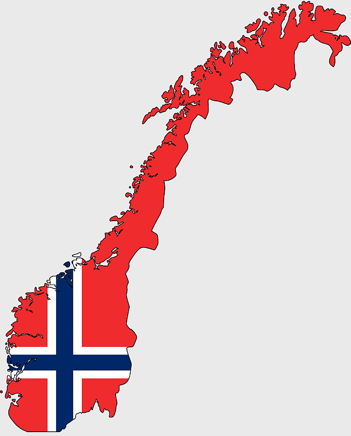
Norway blank map, Norwegian geography, flag of Norway, travel world map, Scandinavian cartography, Nordic region outline, European country borders, PNG free download
Norway blank map, Norwegian geography, flag of Norway, travel world map, Scandinavian cartography, Nordic region outline, European country borders
1000x365pxIndonesia blank map, black silhouette map, monochrome world map, outline map of Indonesia, geographical outline, travel map design, cartographic illustration
850x550pxblue world map, early cartography atlas, political map collection, world map line art, global geography illustration, international map design, earth continent layout
3001x1099pxgrey Indonesia map, blank globe illustration, monochrome country map, flat design travel map, Southeast Asia geography, archipelago outline, island nation cartography
1062x399pxIndonesian Map, red map outline, travel World, cartography, Southeast Asia geography, archipelago nation, island nation map
1280x580pxred and white map illustration, Flag of Indonesia Brunei Map, greater Indonesia map, blank map with flag design, Southeast Asia political map, cartographic design elements, regional geography illustration
7506x8000pxIndia blank map, orange India silhouette, India world map design, stock India map, Indian geography outline, map of South Asia, India political borders
1024x1024pxglobe silhouette, equirectangular projection map, earth icon logo, world map projection, global geography illustration, international cartography design, planet earth visual
4167x2084pxIndonesia map, flat design map, yellow and blue map, travel world map, geographic layout, island nation map, southeast asia cartography
1200x1200pxworld map, computer-generated world map, black and white world map, пробковая карта мира, global geography illustration, international map design, earth continents outline
1100x569pxworld map illustration, dot distribution map, seven continents map, travel around the world, global connectivity, international routes, world geography diagram
1024x1024pxFlag of Indonesia Map, black silhouette map, komodo travel, monochrome Indonesia map, Southeast Asia geography, archipelago nation, island nation outline
1280x801pxFlag of the United States Map, national Flag of USA, travel World with US flag, geography of the United States, American patriotic symbols, USA map design, stars and stripes layout
1427x845pxworld map, flat design map, cartography globe, geography map, global travel map, earth atlas, international map design
2000x1367pxFlag of Mexico Map, Mexican flag overlay, travel Mexico, world map with flag, Mexican cartography, national emblem map, geographic flag design
1217x912pxFlag of China, Provinces of China, red map, national flag, Chinese geography, Asian country map, star symbols
2282x834pxIndonesia flag map, red and white map illustration, national symbols of Indonesia, flag of Indonesia map, Indonesian geography design, Southeast Asia travel map, Asian country flags
440x512pxFlag of Italy, Kingdom of Italy Map, Italian Empire, map of Italy, Italian flag silhouette, boot-shaped country, European nation map
1200x1200pxIndia monochrome map, Indian silhouette map, blank India map, black and white India map, India geographic outline, India country shape, India border illustration
1024x585pxIndonesia map with flag, Indonesian national symbols, red and white map illustration, Flag of Indonesia overlay, Southeast Asia cartography, Indonesian geography visuals, patriotic map design
2292x2334pxFlag of France Map, French Country outline, blank France map, tricolor France flag, European nation borders, French geography, national symbol design
2400x1190pxworld map, blank map, natural Earth, global geography, earth continents, international atlas
1500x1500pxEurope Map, black and white map, silhouette map, travel world, European countries, geographic outline, continent illustration
1249x1041pxFlag of Pakistan map, green and white Pakistan map, Pakistan flag silhouette, topo map of Pakistan, Islamic country map, national symbol map, geographic outline of Pakistan
2640x1674px7 continent world map, color world map, flat world map, world map diagram, global geography map, international travel map, world map infographic
720x720pxUkraine map with flag, Ukrainian national colors, contour line of Ukraine, yellow and blue map, Ukrainian geography, Eastern European borders, Ukrainian travel guide
507x520pxflag of France, French national flag, France map outline, European country flags, French tricolor design, French patriotic symbol, French cultural iconography
700x838pxIndia Map illustration, India political map, blank India map, India state boundaries, Indian subcontinent geography, South Asia cartography, detailed India region map
1280x1584pxFlag of Germany, Allied-occupied Germany Map, blank Map, red yellow black, German territorial divisions, historical Germany map, post-war Germany borders
2602x1952pxEurope political map, European globe map, world geography, European area map, European continent map, European countries outline, European map illustration
1411x550pxIndonesia Map, blue map, travel World, aqua design, Southeast Asia geography, archipelago visualization, cartographic representation
1280x1280pxFlag of Spain, Spain map, national flag, red and yellow, European country flags, Iberian Peninsula, Spanish emblem design
1800x983pxworld map mercator projection, asia ocean map, flat earth globe map, robinson projection world, global geography chart, earth cartography design, world atlas illustration
1425x1199pxChina flag map, Flag of China blank map, red China map, Chinese flag stars, China political map, China geography illustration, China national symbol design
1024x1024pxFlag of Italy, Italian flag icon, green white red colors, Italy travel symbol, national emblem graphic, circular flag design, European country flags
1200x641pxRussia blank map, black and white Russia map, monochrome Russia map, white Russia map, Russian geography, political map of Russia, Russia outline map
1000x1000pxUkraine map, yellow and blue, travel Ukraine, Ukrainian symbol, Eastern European country, national flag design, geopolitical region
1331x2930pxFlag of Argentina Map, argentina travel map, yellow sun emblem, blank map design, south america geography, national symbol art, argentine culture illustration
1024x838pxAmerican flag map, USA patriotic banner, United States flag design, travel world USA, American stars and stripes, USA flag silhouette, American flag geography
544x488pxUkraine map silhouette, black and white Ukraine map, Ukrainian fauna map, travel Ukraine map, geographic outline of Ukraine, Ukrainian landscape illustration, Eastern European cartography
675x421pxMaharashtra map, Maharashtra state outline, Maharashtra geography, Maharashtra region, India state maps, map of Indian states, Maharashtra borders, png
1024x1024pxJapan map silhouette, black and white Japan map, Japan prefectures outline, monochrome Japan map, Japanese geography illustration, Asia travel icon, country shape graphic
1486x610pxFlag of Indonesia Map, Indonesian travel map, blue world map, Indonesian area map, Southeast Asia map, country outline map, travel destination map
892x906pxBrazil regions map, blank Brazil map, political map of Brazil, ecoregions of Brazil, South American geography, Brazilian states outline, map of Brazilian territories
900x900pxKerala Map, India silhouette, blank Kerala map, travel Kerala, South India state, geographical outline, blue region map
578x578pxBrazil map, black and white map, mapa polityczna, travel world, South America geography, political division, country borders
860x698pxworld map illustration, colorful world map, flat design map, world map continents, global geography, world map infographic, international travel map
359x768pxArgentina blank map, Argentine Northwest geography, black and white outline, coloring book map, South American cartography, silhouette map, travel atlas design
1667x1667pxworld map, flat color world map, world map material, color map of the world, global geography illustration, international cartography design, world atlas graphic
925x520pxblue dot world map, global map with dots, flat Earth diagram, blue abstract globe, world map design, international travel map, digital cartography
2339x1377pxRussia Map silhouette, black and white Russia map, blank Russia map, monochrome world map, Russian geography outline, Eurasian landmass shape, northern hemisphere cartography
1024x576pxworld map with flags, globe map design, flags of the world, world flag map, international flag map, global map illustration, world geography chart
900x900pxNizamabad District Map, Telangana State Outline, India Political Map, Yellow Region Highlight, Geographical Borders, Administrative Division, Regional Cartography
1000x550pxMalaysia blank map, Malaysia map, travel world map, geography map, Southeast Asia map, dot pattern map, green background map
510x540pxIndia Globe Map, India world map, orange India map, blank India map, geographical representation, cartographic design, subcontinent outline
1095x2246pxPortugal flag map, red and green flag, Flag of Portugal, national flag, Portuguese geography, Iberian Peninsula map, European country flags
900x900pxKarnataka Legislative Assembly election map, India political map, yellow Karnataka outline, Karnataka election results map, Indian state boundaries, regional election visualization, political geography of Karnataka
1645x1920pxflag of the United Kingdom, England map, union Jack, United Kingdom world map, British Isles geography, UK national emblem, British flag design
2100x1313pxblue world map, cloud map, mappa Mundi, world map stock, pixelated map, global geography, digital cartography
2000x3957pxFlag of Sweden map, Sweden-Norway Union map, blue and yellow flag, political map of Sweden, Scandinavian geography, Nordic borders, historical union map
960x600pxPortugal flag, Portuguese national symbol, green and red rectangle, portuguese emblem, European country flags, national identity icons, world flag collection
595x689pxIndia blank map, political map of India, outline of India, white line map, geographical visualization, country borders, subcontinent layout
720x720pxEarth Globe Illustration, World Map HD, Travel World Map, Planet Earth Grid, Global Geography, Terrestrial Sphere, Continental Atlas
6599x3245pxyellow world map, globe illustration, world map background, travel around the world, global geography, earth continents, international map design
587x600pxGlobe World Earth Emoji, Africa continent map, sphere planet icon, world map projection, global geography illustration, earth emoji graphic, international cartography design
2323x877pxIndonesia Map, independence day indonesia, orange map, blank Map, Southeast Asia geography, archipelagic nation, travel destination Indonesia
1100x479pxwhite and teal island illustration, United States continent map, beautiful world map design, seven continents map, global cartography art, 3D world geography, international travel map
563x618pxBlank Africa map, Africa world map, Blank map Africa, Africa outline, African continent map, unmarked Africa map, Africa geography chart
980x618pxblack silhouette USA map, blank United States map, monochrome map of USA, travel world map USA, geographic outline of America, continental United States shape, minimalist USA cartography
700x700pxFlag of Japan Map, Japan waves map, national Flag of Japan, red Japan map, Japanese geography, Asian cartography, island nation map
1920x1200pxFlag of Norway, Norwegian flag design, Nordic cross flag, red and blue flag, national symbol of Norway, European country flags, Scandinavian flag elements
1280x640pxUkraine flag, Ukrainian national colors, Ukraine map outline, blue and yellow flag, Eastern European symbols, national identity markers, patriotic, png
2290x2285pxFlag of Greece map, Greek national symbol, Greece travel world map, Greek flag overlay, Hellenic geography, Mediterranean country borders, Aegean region cartography
2000x2729pxBangladesh blank map, districts of Bangladesh, division of Bangladesh, black and white map, geographical outline, administrative regions, country borders
1060x660pxEurope blank map, monochrome world map, black and white geography, cartography europe, political map analysis, continental borders visualization, geographic layout study