Brazil Mercator Projection map, Brazil political map, blank Brazil map, Brazil world map, South America cartography, geographic visualization, country borders illustration, PNG free download
Brazil Mercator Projection map, Brazil political map, blank Brazil map, Brazil world map, South America cartography, geographic visualization, country borders illustration
More related PNGs
1000x365pxIndonesia blank map, black silhouette map, monochrome world map, outline map of Indonesia, geographical outline, travel map design, cartographic illustration
850x550pxblue world map, early cartography atlas, political map collection, world map line art, global geography illustration, international map design, earth continent layout
1024x1024pxglobe silhouette, equirectangular projection map, earth icon logo, world map projection, global geography illustration, international cartography design, planet earth visual
700x700pxIndia silhouette map, India map drawing, India world map, India map design, Indian subcontinent outline, South Asia map illustration, India geographic shape
7506x8000pxIndia blank map, orange India silhouette, India world map design, stock India map, Indian geography outline, map of South Asia, India political borders
3001x1099pxgrey Indonesia map, blank globe illustration, monochrome country map, flat design travel map, Southeast Asia geography, archipelago outline, island nation cartography
1266x1113pxgray and white map illustration, location map icon, map with pin, travel world map, navigation guide, geographic locator, destination finder
4167x2084pxIndonesia map, flat design map, yellow and blue map, travel world map, geographic layout, island nation map, southeast asia cartography
1280x580pxred and white map illustration, Flag of Indonesia Brunei Map, greater Indonesia map, blank map with flag design, Southeast Asia political map, cartographic design elements, regional geography illustration
684x980pxmap location icon, black and white location symbol, travel world map art, google maps logo, navigation pin graphic, destination marker design, geographic pointer illustration
1800x983pxworld map mercator projection, asia ocean map, flat earth globe map, robinson projection world, global geography chart, earth cartography design, world atlas illustration
1200x1200pxIndia monochrome map, Indian silhouette map, blank India map, black and white India map, India geographic outline, India country shape, India border illustration
578x578pxBrazil map, black and white map, mapa polityczna, travel world, South America geography, political division, country borders
2000x1367pxFlag of Mexico Map, Mexican flag overlay, travel Mexico, world map with flag, Mexican cartography, national emblem map, geographic flag design
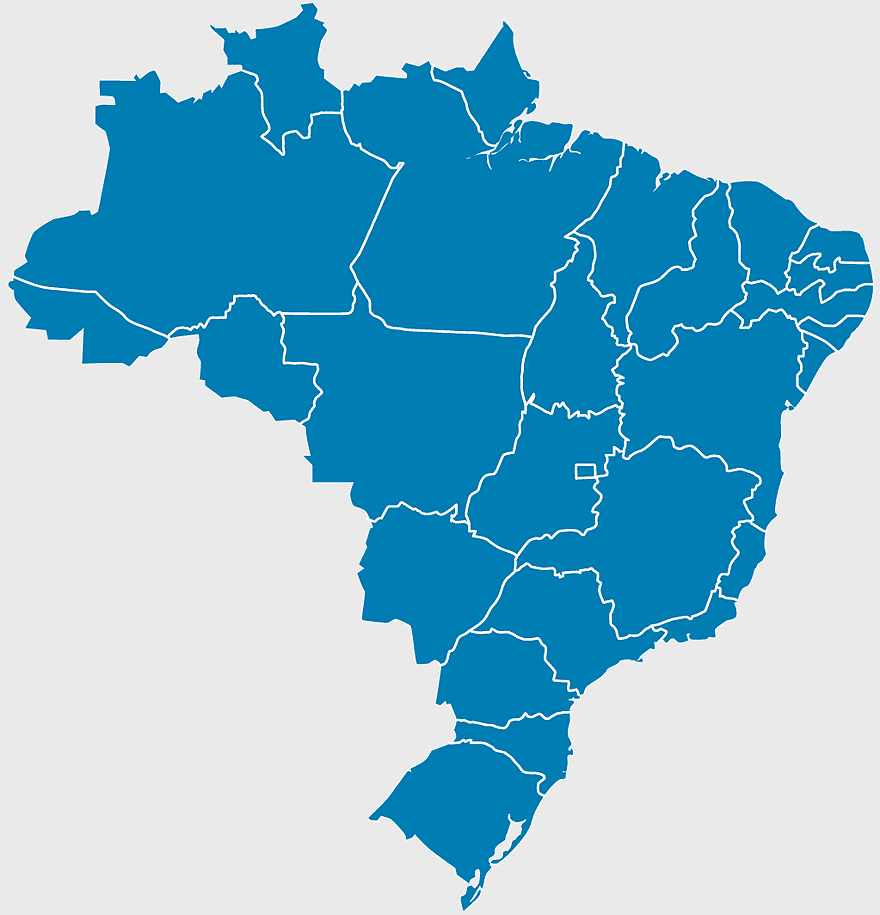
892x906pxBrazil regions map, blank Brazil map, political map of Brazil, ecoregions of Brazil, South American geography, Brazilian states outline, map of Brazilian territories
700x838pxIndia Map illustration, India political map, blank India map, India state boundaries, Indian subcontinent geography, South Asia cartography, detailed India region map
742x866pxSouth America map, Latin America political map, blank Americas map, latino integration, South American geography, political boundaries Americas, continental map analysis
2953x1911pxworld map silhouette, monochrome world map, black and white globe, raster world map, global atlas design, earth map illustration, political map outline
1000x1000pxnorth map symbol, cardinal direction icon, compass illustration, travel world map, navigation graphic, directional sign, geographic marker
595x689pxIndia blank map, political map of India, outline of India, white line map, geographical visualization, country borders, subcontinent layout
1200x1200pxmap pin icon, location symbol, travel world pin, noun project map pin, navigation marker, geographic pointer, destination tag
1600x1135pxworld map illustration, mercator projection map, elegant world map design, political world map, global geography infographic, international borders visualization, earth continents layout
1500x1500pxEurope Map, black and white map, silhouette map, travel world, European countries, geographic outline, continent illustration
1331x2930pxFlag of Argentina Map, argentina travel map, yellow sun emblem, blank map design, south america geography, national symbol art, argentine culture illustration
600x600pxBrazil blank map, blank Brazil map, blue world map, stock Brazil diagram, geographical layout, country outline, South America borders
1024x585pxIndonesia map with flag, Indonesian national symbols, red and white map illustration, Flag of Indonesia overlay, Southeast Asia cartography, Indonesian geography visuals, patriotic map design
498x560pxLatin America map, South America political map, black and white Americas map, world map with Latin America, geographic layout of South America, political boundaries of Latin America, monochrome continent map
510x540pxIndia Globe Map, India world map, orange India map, blank India map, geographical representation, cartographic design, subcontinent outline
6024x3612pxwatercolor world map, multicolored globe illustration, creative map design, world map material, artistic cartography, global watercolor art, international map decor
2455x1318pxworld map mercator projection, flat earth society globe, black and white cartography, early world maps design, global geography illustration, continental layout visualization, historical cartographic art
1060x660pxEurope blank map, monochrome world map, black and white geography, cartography europe, political map analysis, continental borders visualization, geographic layout study
1425x1199pxChina flag map, Flag of China blank map, red China map, Chinese flag stars, China political map, China geography illustration, China national symbol design
900x900pxKerala Map, India silhouette, blank Kerala map, travel Kerala, South India state, geographical outline, blue region map
900x900pxNizamabad District Map, Telangana State Outline, India Political Map, Yellow Region Highlight, Geographical Borders, Administrative Division, Regional Cartography
1300x1300pxVenezuela Petro Map Flag, Venezuelan Flag Map, cryptocurrency Venezuela map, travel Venezuela map, South America country flag, national symbol Venezuela, Venezuela geographic representation
980x618pxblack silhouette USA map, blank United States map, monochrome map of USA, travel world map USA, geographic outline of America, continental United States shape, minimalist USA cartography
1428x732pxworld map mercator projection, monochrome political map, south-up world map, blank map for coloring, global geography illustration, international borders outline, cartographic design elements
587x600pxGlobe World Earth Emoji, Africa continent map, sphere planet icon, world map projection, global geography illustration, earth emoji graphic, international cartography design
1667x1667pxworld map, flat color world map, world map material, color map of the world, global geography illustration, international cartography design, world atlas graphic
2602x1952pxEurope political map, European globe map, world geography, European area map, European continent map, European countries outline, European map illustration
1213x512pxblue world map, Mercator Projection map, world geography illustration, mapa Mundi drawing, global cartography, international atlas, earth visualization
1437x1495pxAsia continental map, Asia Europe globe, mercator projection map, blank Asia map, world geography, global cartography, continental boundaries
544x488pxUkraine map silhouette, black and white Ukraine map, Ukrainian fauna map, travel Ukraine map, geographic outline of Ukraine, Ukrainian landscape illustration, Eastern European cartography
1920x2400pxBangladesh silhouette map, black and white Bangladesh map, blank Bangladesh map, monochrome Bangladesh map, Bangladesh geographic outline, Bangladesh country shape, Bangladesh political borders
2292x2334pxFlag of France Map, French Country outline, blank France map, tricolor France flag, European nation borders, French geography, national symbol design
500x721pxPeru political map, Lima city map, black and white world map, map of Peru, South America geography, country borders illustration, travel destination guide
688x838pxSouth America blank map, Central America monochrome map, Latin America line art, Americas geography illustration, political map of South America, educational map drawing, travel map of Americas
359x768pxArgentina blank map, Argentine Northwest geography, black and white outline, coloring book map, South American cartography, silhouette map, travel atlas design
2000x2000pxblack Brazil map illustration, Flag of Brazil blank map, black and white cartography, topo map of Brazil, geographic outline of Brazil, line art map design, early world map style
1600x1000pxIndia silhouette map, black and white India map, India political map, India map collection, geographical outline of India, country borders of India, South Asia map illustration
830x550pxAsia Mercator Projection map, blue Asia world map, Asia continent map, travel Asia map, global Asia cartography, geographic Asia visualization, Asia map design elements
2379x2178pxgoogle map illustration, location icon symbol, travel world map, technology icons, digital navigation tools, map marker design, geographic location points
2339x1377pxRussia Map silhouette, black and white Russia map, blank Russia map, monochrome world map, Russian geography outline, Eurasian landmass shape, northern hemisphere cartography
1242x1128pxflag of brazil map, map of brazil, brazilian geography, world map graphic, 3D map illustration, cities in brazil, south america political map
882x1280pxSouth America map coloring page, Latin America blank map, monochrome world map, black and white continent outline, educational geography illustration, printable line art map, travel world map design
500x500pxglobe monochrome silhouette, equirectangular projection map, world map metal powder, black and white earth, global geography illustration, cartographic design, monochromatic planet image
1656x2282pxBangladesh blank map, green map outline, mercator projection map, travel world map, geographic region, country borders, cartographic design
1767x1147pxworld map blue, globe projection, mercator scale, topojson geography, global cartography, earth atlas, international borders
2000x2729pxBangladesh blank map, districts of Bangladesh, division of Bangladesh, black and white map, geographical outline, administrative regions, country borders
640x640pxflags of South America map, Latin America country flags, South America blank map, flags of the Americas, South American travel destinations, Andean nation symbols, Mercosur member states
900x900pxLatin America map with flags, flags of South America, South America map, national flags of Latin America, Americas geography, South American countries, map of South American nations
1001x555pxRussia political map, карта россии, world map cartography, mapa polityczna Russia, Russian federation regions, geopolitical boundaries, Eurasian territories
1928x1920pxBrazil map flag, Brazilian flag design, Brazil country outline, Brazil national symbol, South America geography, green and yellow emblem, Ordem e Progresso motto
5136x3072pxAntarctica map HD, Map of the world exquisite, world Cup travel, plate world map, global geographical visualization, high-resolution world atlas, seven continents cartography
555x802pxPeru flag map, flag of Peru, Peru map outline, red and white flag, South American country flags, national symbol illustration, geographic boundary design
800x465pxmonochrome world map, mercator projection silhouette, black and white globe, early world maps, global geography illustration, cartographic design, vintage map aesthetics
1100x479pxwhite and teal island illustration, United States continent map, beautiful world map design, seven continents map, global cartography art, 3D world geography, international travel map
500x500pxMaharashtra blank map, black and white silhouette, travel world map, stock map image, geographic outline, state boundary illustration, cartographic design
5748x5852pxEarth World Globe, Cartoon World Map, green planet illustration, free content globe image, global geography graphic, world atlas visual, spherical earth depiction
2000x1022pxworld map continents, robinson projection map, blank world map, travel world map, global geography, earth atlas, international borders
1000x526pxgray world map, dot distribution map, monochrome globe, black and white cartography, global geography illustration, international point map, world atlas design
637x738pxLatin America Map, South America map, Caribbean political map, Maxxess Systems Inc coverage areas, Americas regional map content, examined world cartography, distinctive map visualizations
1491x1600pxAfrica map with flags, African national flags, world map with country flags, pan-African flag design, African political boundaries, continent flag collage, African cultural symbols
1200x630pxIndonesia flag map, red and white country illustration, Pembela Tanah Air map, Indonesian national symbol, Southeast Asia cartography, patriotic design elements, historical geography visuals