Telangana state map, India blank map, states and territories of India, road map of India, political map of India, geographical map illustration, cartographic representation of India, PNG free download
Telangana state map, India blank map, states and territories of India, road map of India, political map of India, geographical map illustration, cartographic representation of India
1000x365pxIndonesia blank map, black silhouette map, monochrome world map, outline map of Indonesia, geographical outline, travel map design, cartographic illustration
700x700pxIndia silhouette map, India map drawing, India world map, India map design, Indian subcontinent outline, South Asia map illustration, India geographic shape
1280x580pxred and white map illustration, Flag of Indonesia Brunei Map, greater Indonesia map, blank map with flag design, Southeast Asia political map, cartographic design elements, regional geography illustration
1480x793pxmap location icon, medicines authority logo, travel world map, map pointer, geographic navigation, location marker design, cartographic symbol
850x550pxblue world map, early cartography atlas, political map collection, world map line art, global geography illustration, international map design, earth continent layout
7506x8000pxIndia blank map, orange India silhouette, India world map design, stock India map, Indian geography outline, map of South Asia, India political borders
576x644pxIndian flag map, Independence Day illustration, tricolor India design, Falun India icon, patriotic map graphic, national symbol art, independence celebration
1266x1113pxgray and white map illustration, location map icon, map with pin, travel world map, navigation guide, geographic locator, destination finder
2362x3543pxdollar sign illustration, golden dollar symbol, financial icon, United States currency, wealth representation, economic symbol, monetary emblem
586x586pxmoney illustration, cash payment diagram, united states dollar bills, gold bars with cash, financial assets visual, wealth representation art, currency stack graphic
1200x1200pxIndia monochrome map, Indian silhouette map, blank India map, black and white India map, India geographic outline, India country shape, India border illustration
684x980pxmap location icon, black and white location symbol, travel world map art, google maps logo, navigation pin graphic, destination marker design, geographic pointer illustration
510x540pxIndia Globe Map, India world map, orange India map, blank India map, geographical representation, cartographic design, subcontinent outline
1000x1000pxEarth Globe, world map, environmental protection, flat Earth, global sustainability, planet illustration, cartographic design
1502x1658pxAfrica silhouette map, black and white Africa map, monochrome Africa graphic, blank Africa map, African continent outline, geographical Africa shape, Africa continent
603x1024pxLion Capital of Ashoka, Satyameva Jayate, State Emblem of India, monochrome logo, Indian national symbols, Ashoka pillar iconography, heritage art illustration
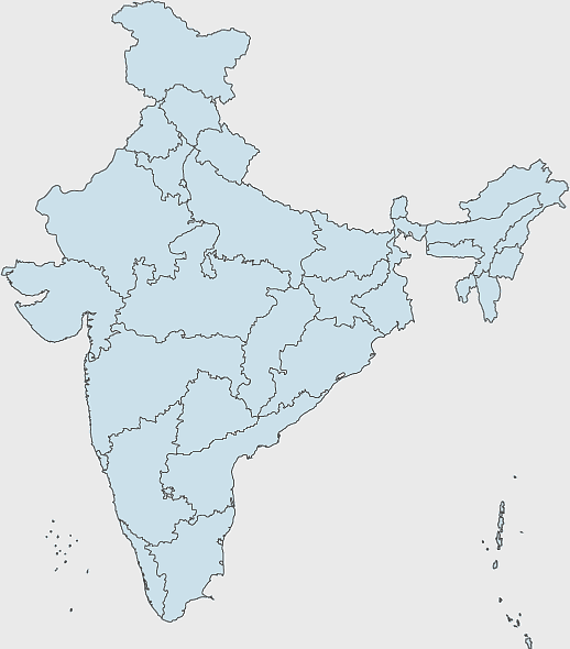
700x838pxIndia Map illustration, India political map, blank India map, India state boundaries, Indian subcontinent geography, South Asia cartography, detailed India region map
3001x1099pxgrey Indonesia map, blank globe illustration, monochrome country map, flat design travel map, Southeast Asia geography, archipelago outline, island nation cartography
1280x1584pxFlag of Germany, Allied-occupied Germany Map, blank Map, red yellow black, German territorial divisions, historical Germany map, post-war Germany borders
500x849pxGovernment of India emblem, Ministry of Agriculture logo, Farmers Welfare symbol, Indian state seal, Ashoka Chakra icon, agricultural policy illustration, national governance
900x900pxKerala Map, India silhouette, blank Kerala map, travel Kerala, South India state, geographical outline, blue region map
892x906pxBrazil regions map, blank Brazil map, political map of Brazil, ecoregions of Brazil, South American geography, Brazilian states outline, map of Brazilian territories
2000x5697pxPalestine Flag Map, State of Palestine Map, Mandatory Palestine Flag, Palestine Flag Artwork, Middle East Political Map, Arab Flag Design, Historical Palestine Territory
1411x550pxIndonesia Map, blue map, travel World, aqua design, Southeast Asia geography, archipelago visualization, cartographic representation
595x689pxIndia blank map, political map of India, outline of India, white line map, geographical visualization, country borders, subcontinent layout
1675x2000pxglobe, sphere, world map, digital planet, educational tool, geographical representation, earth model
900x900pxNizamabad District Map, Telangana State Outline, India Political Map, Yellow Region Highlight, Geographical Borders, Administrative Division, Regional Cartography
900x900pxKarnataka Legislative Assembly election map, India political map, yellow Karnataka outline, Karnataka election results map, Indian state boundaries, regional election visualization, political geography of Karnataka
1200x641pxRussia blank map, black and white Russia map, monochrome Russia map, white Russia map, Russian geography, political map of Russia, Russia outline map
1425x1199pxChina flag map, Flag of China blank map, red China map, Chinese flag stars, China political map, China geography illustration, China national symbol design
1000x1000pxnorth map symbol, cardinal direction icon, compass illustration, travel world map, navigation graphic, directional sign, geographic marker
2953x1911pxworld map silhouette, monochrome world map, black and white globe, raster world map, global atlas design, earth map illustration, political map outline
736x507pxRussia orange map, Russian city map, blank Russia map, scale map of Russia, Russian geography, political map of Russia, Russian urban areas
675x421pxMaharashtra map, Maharashtra state outline, Maharashtra geography, Maharashtra region, India state maps, map of Indian states, Maharashtra borders, png
2000x2171pxTamil Nadu Government Seal, Tamil Nadu Legislative Assembly emblem, State Emblem of India, gopuram temple illustration, Indian state symbols, Tamil Nadu official logo, South Indian government insignia
450x600pxState Emblem of India, Ashok Stambh, national symbol India, lion illustration, Indian cultural icon, historical emblem design, golden lion sculpture
500x500pxMaharashtra blank map, black and white silhouette, travel world map, stock map image, geographic outline, state boundary illustration, cartographic design
734x815pxIndia silhouette map, black and white India map, monochrome India outline, India map, geographical representation of India, country shape illustration, Indian subcontinent outline
2116x1440pxblue world map, earth globe illustration, three-dimensional earth, green planet, global geography, terrestrial sphere, cartographic design
742x866pxSouth America map, Latin America political map, blank Americas map, latino integration, South American geography, political boundaries Americas, continental map analysis
943x1091pxblank India map, states and territories of India outline, monochrome Indian political map, central India geography, Indian borderlines illustration, subcontinental regions layout, location markers on India无声無息无声无息无声无息China
980x618pxblack silhouette USA map, blank United States map, monochrome map of USA, travel world map USA, geographic outline of America, continental United States shape, minimalist USA cartography
1500x1500pxEurope Map, black and white map, silhouette map, travel world, European countries, geographic outline, continent illustration
1600x1000pxIndia silhouette map, black and white India map, India political map, India map collection, geographical outline of India, country borders of India, South Asia map illustration
544x488pxUkraine map silhouette, black and white Ukraine map, Ukrainian fauna map, travel Ukraine map, geographic outline of Ukraine, Ukrainian landscape illustration, Eastern European cartography
512x512pxMaharashtra Blank map, orange silhouette map, road map topo, city map India, geospatial visualization, state boundary outlines, cartographic graphic design
1331x2930pxFlag of Argentina Map, argentina travel map, yellow sun emblem, blank map design, south america geography, national symbol art, argentine culture illustration
500x500pxglobe monochrome silhouette, equirectangular projection map, world map metal powder, black and white earth, global geography illustration, cartographic design, monochromatic planet image
1060x660pxEurope blank map, monochrome world map, black and white geography, cartography europe, political map analysis, continental borders visualization, geographic layout study
1115x1280pxIndia flag map, Indian national symbol, tricolor India map, blank India map, political map of India, Ashoka Chakra design, Indian geography outline
1500x1500pxIndian Independence Day illustration, August 15th celebration, Flag of India design, India Independence Day art, patriotic floral design, vibrant cultural map, festive national holiday
1920x2400pxBangladesh silhouette map, black and white Bangladesh map, blank Bangladesh map, monochrome Bangladesh map, Bangladesh geographic outline, Bangladesh country shape, Bangladesh political borders
1001x555pxRussia political map, карта россии, world map cartography, mapa polityczna Russia, Russian federation regions, geopolitical boundaries, Eurasian territories
2379x2178pxgoogle map illustration, location icon symbol, travel world map, technology icons, digital navigation tools, map marker design, geographic location points
1300x1300pxVenezuela Petro Map Flag, Venezuelan Flag Map, cryptocurrency Venezuela map, travel Venezuela map, South America country flag, national symbol Venezuela, Venezuela geographic representation
2602x1952pxEurope political map, European globe map, world geography, European area map, European continent map, European countries outline, European map illustration
1428x732pxworld map mercator projection, monochrome political map, south-up world map, blank map for coloring, global geography illustration, international borders outline, cartographic design elements
498x560pxLatin America map, South America political map, black and white Americas map, world map with Latin America, geographic layout of South America, political boundaries of Latin America, monochrome continent map
671x692pxIndia 3D map, turquoise India map, 3D computer graphics map, India world map, digital India cartography, 3D geographic visualization, aqua cartographic design
800x800pxorange globe, world map sphere, earth icon, political map, global geography, planet illustration, cartographic design
1024x1024pxRajasthan map, blue map outline, travel world map, blank map template, geographical region, state boundary, cartographic design
534x1600pxPalestinian territories map, flag of Palestine, State of Palestine, mandatory Palestine, Middle East geopolitics, Arab flag design, historical land division
500x500pxPaper Technology roadmap, road with pins illustration, Technology roadmap, city Map, strategic planning, visual navigation, milestone markers
2000x2729pxBangladesh blank map, districts of Bangladesh, division of Bangladesh, black and white map, geographical outline, administrative regions, country borders
800x842pxgreen road signage, large green road sign, blank directions sign, traffic sign, street sign design, road sign illustration, directional sign post
4013x1478pxFlag of Indonesia map, red and white Indonesia illustration, Indonesia globe map, pembela Tanah Air symbol, Southeast Asia cartography, national emblem design, Indonesian territorial outline
694x709pxAfrica map, orange Africa map, world map, Africa continent map, geographical representation, continental layout, visual geography of Africa
800x583pxMexico United States border map, blank political map, black and white world map, monochrome country diagram, international geography layout, cartographic line art, travel destination atlas
1600x1135pxworld map illustration, mercator projection map, elegant world map design, political world map, global geography infographic, international borders visualization, earth continents layout