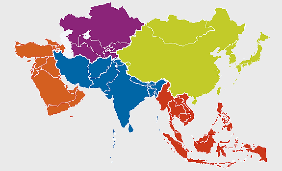
Asia political map, blank Asia map, travel Asia map, top 10 Asian countries, Asian geography, Asian continent map, Asian country borders, PNG free download
Asia political map, blank Asia map, travel Asia map, top 10 Asian countries, Asian geography, Asian continent map, Asian country borders
More related PNGs
1000x365pxIndonesia blank map, black silhouette map, monochrome world map, outline map of Indonesia, geographical outline, travel map design, cartographic illustration
850x550pxblue world map, early cartography atlas, political map collection, world map line art, global geography illustration, international map design, earth continent layout
3001x1099pxgrey Indonesia map, blank globe illustration, monochrome country map, flat design travel map, Southeast Asia geography, archipelago outline, island nation cartography
1280x580pxred and white map illustration, Flag of Indonesia Brunei Map, greater Indonesia map, blank map with flag design, Southeast Asia political map, cartographic design elements, regional geography illustration
7506x8000pxIndia blank map, orange India silhouette, India world map design, stock India map, Indian geography outline, map of South Asia, India political borders
1062x399pxIndonesian Map, red map outline, travel World, cartography, Southeast Asia geography, archipelago nation, island nation map
1100x569pxworld map illustration, dot distribution map, seven continents map, travel around the world, global connectivity, international routes, world geography diagram
4167x2084pxIndonesia map, flat design map, yellow and blue map, travel world map, geographic layout, island nation map, southeast asia cartography
2282x834pxIndonesia flag map, red and white map illustration, national symbols of Indonesia, flag of Indonesia map, Indonesian geography design, Southeast Asia travel map, Asian country flags
1502x1658pxAfrica silhouette map, black and white Africa map, monochrome Africa graphic, blank Africa map, African continent outline, geographical Africa shape, Africa continent
1217x912pxFlag of China, Provinces of China, red map, national flag, Chinese geography, Asian country map, star symbols
1024x1024pxFlag of Indonesia Map, black silhouette map, komodo travel, monochrome Indonesia map, Southeast Asia geography, archipelago nation, island nation outline
1200x1200pxworld map, computer-generated world map, black and white world map, пробковая карта мира, global geography illustration, international map design, earth continents outline
2400x1190pxworld map, blank map, natural Earth, global geography, earth continents, international atlas
1411x550pxIndonesia Map, blue map, travel World, aqua design, Southeast Asia geography, archipelago visualization, cartographic representation
2640x1674px7 continent world map, color world map, flat world map, world map diagram, global geography map, international travel map, world map infographic
1200x1200pxIndia monochrome map, Indian silhouette map, blank India map, black and white India map, India geographic outline, India country shape, India border illustration
700x838pxIndia Map illustration, India political map, blank India map, India state boundaries, Indian subcontinent geography, South Asia cartography, detailed India region map
1200x641pxRussia blank map, black and white Russia map, monochrome Russia map, white Russia map, Russian geography, political map of Russia, Russia outline map
1024x585pxIndonesia map with flag, Indonesian national symbols, red and white map illustration, Flag of Indonesia overlay, Southeast Asia cartography, Indonesian geography visuals, patriotic map design
1024x1024pxJapan map silhouette, black and white Japan map, Japan prefectures outline, monochrome Japan map, Japanese geography illustration, Asia travel icon, country shape graphic
1427x845pxworld map, flat design map, cartography globe, geography map, global travel map, earth atlas, international map design
1425x1199pxChina flag map, Flag of China blank map, red China map, Chinese flag stars, China political map, China geography illustration, China national symbol design
1280x801pxFlag of the United States Map, national Flag of USA, travel World with US flag, geography of the United States, American patriotic symbols, USA map design, stars and stripes layout
2602x1952pxEurope political map, European globe map, world geography, European area map, European continent map, European countries outline, European map illustration
578x578pxBrazil map, black and white map, mapa polityczna, travel world, South America geography, political division, country borders
1500x1500pxEurope Map, black and white map, silhouette map, travel world, European countries, geographic outline, continent illustration
2323x877pxIndonesia Map, independence day indonesia, orange map, blank Map, Southeast Asia geography, archipelagic nation, travel destination Indonesia
736x507pxRussia orange map, Russian city map, blank Russia map, scale map of Russia, Russian geography, political map of Russia, Russian urban areas
860x698pxworld map illustration, colorful world map, flat design map, world map continents, global geography, world map infographic, international travel map
1000x550pxMalaysia blank map, Malaysia map, travel world map, geography map, Southeast Asia map, dot pattern map, green background map
1280x1584pxFlag of Germany, Allied-occupied Germany Map, blank Map, red yellow black, German territorial divisions, historical Germany map, post-war Germany borders
2292x2334pxFlag of France Map, French Country outline, blank France map, tricolor France flag, European nation borders, French geography, national symbol design
1331x2930pxFlag of Argentina Map, argentina travel map, yellow sun emblem, blank map design, south america geography, national symbol art, argentine culture illustration
444x701pxEngland Map UK, flag of the United Kingdom, map of Great Britain, blue and red design, British geography, UK political division, Union Jack overlay
1800x983pxworld map mercator projection, asia ocean map, flat earth globe map, robinson projection world, global geography chart, earth cartography design, world atlas illustration
2480x3508pxAfrica Map, orange continent, world Map, emblem Of The African Union, African geography, cartographic design, orange silhouette
720x720pxUkraine map with flag, Ukrainian national colors, contour line of Ukraine, yellow and blue map, Ukrainian geography, Eastern European borders, Ukrainian travel guide
1486x610pxFlag of Indonesia Map, Indonesian travel map, blue world map, Indonesian area map, Southeast Asia map, country outline map, travel destination map
892x906pxBrazil regions map, blank Brazil map, political map of Brazil, ecoregions of Brazil, South American geography, Brazilian states outline, map of Brazilian territories
595x689pxIndia blank map, political map of India, outline of India, white line map, geographical visualization, country borders, subcontinent layout
742x866pxSouth America map, Latin America political map, blank Americas map, latino integration, South American geography, political boundaries Americas, continental map analysis
1024x377pxFlag of Indonesia Map, black and white map, Indonesia line art, monochrome travel map, Southeast Asia geography, archipelago illustration, political boundaries
6599x3245pxyellow world map, globe illustration, world map background, travel around the world, global geography, earth continents, international map design
1600x1135pxworld map illustration, mercator projection map, elegant world map design, political world map, global geography infographic, international borders visualization, earth continents layout
563x618pxBlank Africa map, Africa world map, Blank map Africa, Africa outline, African continent map, unmarked Africa map, Africa geography chart
900x900pxKarnataka Legislative Assembly election map, India political map, yellow Karnataka outline, Karnataka election results map, Indian state boundaries, regional election visualization, political geography of Karnataka
1100x479pxwhite and teal island illustration, United States continent map, beautiful world map design, seven continents map, global cartography art, 3D world geography, international travel map
359x768pxArgentina blank map, Argentine Northwest geography, black and white outline, coloring book map, South American cartography, silhouette map, travel atlas design
1200x600pxFlag of Indonesia, Indonesian national flag map, red and white flag design, Indonesia country map, Southeast Asian flags, Asian geography maps, flag symbolism in Asia
2000x1022pxworld map continents, robinson projection map, blank world map, travel world map, global geography, earth atlas, international borders
587x600pxGlobe World Earth Emoji, Africa continent map, sphere planet icon, world map projection, global geography illustration, earth emoji graphic, international cartography design
660x660pxglobe, world map, United States, sphere, global geography, earth atlas, international continents
1437x1495pxAsia continental map, Asia Europe globe, mercator projection map, blank Asia map, world geography, global cartography, continental boundaries
900x900pxKerala Map, India silhouette, blank Kerala map, travel Kerala, South India state, geographical outline, blue region map
675x421pxMaharashtra map, Maharashtra state outline, Maharashtra geography, Maharashtra region, India state maps, map of Indian states, Maharashtra borders, png
1024x838pxAmerican flag map, USA patriotic banner, United States flag design, travel world USA, American stars and stripes, USA flag silhouette, American flag geography
1060x660pxEurope blank map, monochrome world map, black and white geography, cartography europe, political map analysis, continental borders visualization, geographic layout study
500x721pxPeru political map, Lima city map, black and white world map, map of Peru, South America geography, country borders illustration, travel destination guide
1920x2400pxBangladesh silhouette map, black and white Bangladesh map, blank Bangladesh map, monochrome Bangladesh map, Bangladesh geographic outline, Bangladesh country shape, Bangladesh political borders
720x720pxEarth Globe Illustration, World Map HD, Travel World Map, Planet Earth Grid, Global Geography, Terrestrial Sphere, Continental Atlas
1491x1600pxAfrica map with flags, African national flags, world map with country flags, pan-African flag design, African political boundaries, continent flag collage, African cultural symbols
2000x855pxFlag of Indonesia Map, Indonesian travel map, world map design, area map of Indonesia, Southeast Asia map, political map of Indonesia, Indonesian geography illustration
8000x4972pxJapan flag, red circle flag, Japanese national symbol, travel Japan, Asian country flag, white background flag, patriotic emblem
1200x630pxIndonesia flag map, red and white country illustration, Pembela Tanah Air map, Indonesian national symbol, Southeast Asia cartography, patriotic design elements, historical geography visuals
1600x1000pxIndia silhouette map, black and white India map, India political map, India map collection, geographical outline of India, country borders of India, South Asia map illustration
882x1280pxSouth America map coloring page, Latin America blank map, monochrome world map, black and white continent outline, educational geography illustration, printable line art map, travel world map design
700x700pxFlag of Japan Map, Japan waves map, national Flag of Japan, red Japan map, Japanese geography, Asian cartography, island nation map
830x550pxAsia Mercator Projection map, blue Asia world map, Asia continent map, travel Asia map, global Asia cartography, geographic Asia visualization, Asia map design elements
1000x1000pxUkraine map, yellow and blue, travel Ukraine, Ukrainian symbol, Eastern European country, national flag design, geopolitical region
2339x1377pxRussia Map silhouette, black and white Russia map, blank Russia map, monochrome world map, Russian geography outline, Eurasian landmass shape, northern hemisphere cartography
1280x689pxworld map drawing, monochrome globe art, white line tattoo, blank map stencil, global geography outline, earth continents sketch, minimalist cartography design
800x738pxAustralia monochrome map, black silhouette world map, Australia blank map, geography atlas, Australian continent outline, global monochrome cartography, earth silhouette illustration
576x602pxAfrica blank map, black and white continent outline, monochrome line art geography, stock Africa, geographical sketch, minimalist cartography, white background continents
688x838pxSouth America blank map, Central America monochrome map, Latin America line art, Americas geography illustration, political map of South America, educational map drawing, travel map of Americas