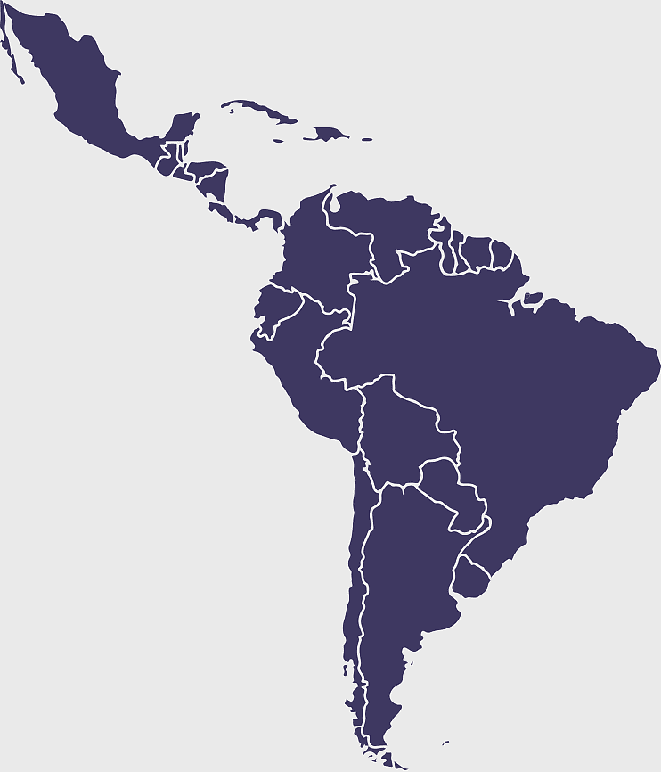
South America map, Latin America political map, blank Americas map, latino integration, South American geography, political boundaries Americas, continental map analysis, PNG free download
South America map, Latin America political map, blank Americas map, latino integration, South American geography, political boundaries Americas, continental map analysis
More related PNGs
850x550pxblue world map, early cartography atlas, political map collection, world map line art, global geography illustration, international map design, earth continent layout
7506x8000pxIndia blank map, orange India silhouette, India world map design, stock India map, Indian geography outline, map of South Asia, India political borders
1280x580pxred and white map illustration, Flag of Indonesia Brunei Map, greater Indonesia map, blank map with flag design, Southeast Asia political map, cartographic design elements, regional geography illustration
3001x1099pxgrey Indonesia map, blank globe illustration, monochrome country map, flat design travel map, Southeast Asia geography, archipelago outline, island nation cartography
1024x1008pxFlag of Brazil, Ordem E Progresso, Brazil globe map, national flag, South American geography, Brazilian emblem, green and yellow design
700x838pxIndia Map illustration, India political map, blank India map, India state boundaries, Indian subcontinent geography, South Asia cartography, detailed India region map
1331x2930pxFlag of Argentina Map, argentina travel map, yellow sun emblem, blank map design, south america geography, national symbol art, argentine culture illustration
892x906pxBrazil regions map, blank Brazil map, political map of Brazil, ecoregions of Brazil, South American geography, Brazilian states outline, map of Brazilian territories
1200x641pxRussia blank map, black and white Russia map, monochrome Russia map, white Russia map, Russian geography, political map of Russia, Russia outline map
498x560pxLatin America map, South America political map, black and white Americas map, world map with Latin America, geographic layout of South America, political boundaries of Latin America, monochrome continent map
1280x801pxFlag of the United States Map, national Flag of USA, travel World with US flag, geography of the United States, American patriotic symbols, USA map design, stars and stripes layout
1425x1199pxChina flag map, Flag of China blank map, red China map, Chinese flag stars, China political map, China geography illustration, China national symbol design
2400x1190pxworld map, blank map, natural Earth, global geography, earth continents, international atlas
736x507pxRussia orange map, Russian city map, blank Russia map, scale map of Russia, Russian geography, political map of Russia, Russian urban areas
578x578pxBrazil map, black and white map, mapa polityczna, travel world, South America geography, political division, country borders
900x900pxKarnataka Legislative Assembly election map, India political map, yellow Karnataka outline, Karnataka election results map, Indian state boundaries, regional election visualization, political geography of Karnataka
688x838pxSouth America blank map, Central America monochrome map, Latin America line art, Americas geography illustration, political map of South America, educational map drawing, travel map of Americas
444x701pxEngland Map UK, flag of the United Kingdom, map of Great Britain, blue and red design, British geography, UK political division, Union Jack overlay
500x500pxFlag of Colombia, Colombian national flag, flags of South America, yellow blue red stripes, South American flag design, tricolor flag representation, Colombian patriotic symbol
900x900pxLatin America map with flags, flags of South America, South America map, national flags of Latin America, Americas geography, South American countries, map of South American nations
359x768pxArgentina blank map, Argentine Northwest geography, black and white outline, coloring book map, South American cartography, silhouette map, travel atlas design
2000x2670pxGran Colombia map, Flag of Colombia silhouette, Colombia national flag, yellow Colombia map, South American historical maps, Colombian geography visuals, historical flag designs
1060x660pxEurope blank map, monochrome world map, black and white geography, cartography europe, political map analysis, continental borders visualization, geographic layout study
1437x1495pxAsia continental map, Asia Europe globe, mercator projection map, blank Asia map, world geography, global cartography, continental boundaries
1280x800px3D Earth globe, world map sphere, raised relief map, geo information system, global geography, planet earth visualization, continental landmasses
1024x838pxAmerican flag map, USA patriotic banner, United States flag design, travel world USA, American stars and stripes, USA flag silhouette, American flag geography
882x1280pxSouth America map coloring page, Latin America blank map, monochrome world map, black and white continent outline, educational geography illustration, printable line art map, travel world map design
1024x377pxFlag of Indonesia Map, black and white map, Indonesia line art, monochrome travel map, Southeast Asia geography, archipelago illustration, political boundaries
720x720pxEarth Globe Illustration, World Map HD, Travel World Map, Planet Earth Grid, Global Geography, Terrestrial Sphere, Continental Atlas
640x640pxflags of South America map, Latin America country flags, South America blank map, flags of the Americas, South American travel destinations, Andean nation symbols, Mercosur member states
900x900pxKerala Map, India silhouette, blank Kerala map, travel Kerala, South India state, geographical outline, blue region map
2000x3000pxReligion in South Korea, South Korea map, Korean Buddhism, provinces of South Korea, Korean cultural geography, Korean religious landscape, Korean spiritual regions
980x618pxblack silhouette USA map, blank United States map, monochrome map of USA, travel world map USA, geographic outline of America, continental United States shape, minimalist USA cartography
2602x1952pxEurope political map, European globe map, world geography, European area map, European continent map, European countries outline, European map illustration
2323x877pxIndonesia Map, independence day indonesia, orange map, blank Map, Southeast Asia geography, archipelagic nation, travel destination Indonesia
1000x550pxMalaysia blank map, Malaysia map, travel world map, geography map, Southeast Asia map, dot pattern map, green background map
2292x2334pxFlag of France Map, French Country outline, blank France map, tricolor France flag, European nation borders, French geography, national symbol design
1200x1200pxFlag of Peru, Peru national football team, flags of South America, state flag, South American emblem, national symbol, Peruvian coat of arms
500x721pxPeru political map, Lima city map, black and white world map, map of Peru, South America geography, country borders illustration, travel destination guide
595x689pxIndia blank map, political map of India, outline of India, white line map, geographical visualization, country borders, subcontinent layout
563x618pxBlank Africa map, Africa world map, Blank map Africa, Africa outline, African continent map, unmarked Africa map, Africa geography chart
1300x1300pxVenezuela Petro Map Flag, Venezuelan Flag Map, cryptocurrency Venezuela map, travel Venezuela map, South America country flag, national symbol Venezuela, Venezuela geographic representation
1428x732pxworld map mercator projection, monochrome political map, south-up world map, blank map for coloring, global geography illustration, international borders outline, cartographic design elements
555x802pxPeru flag map, flag of Peru, Peru map outline, red and white flag, South American country flags, national symbol illustration, geographic boundary design
2339x1377pxRussia Map silhouette, black and white Russia map, blank Russia map, monochrome world map, Russian geography outline, Eurasian landmass shape, northern hemisphere cartography
1600x1135pxworld map illustration, mercator projection map, elegant world map design, political world map, global geography infographic, international borders visualization, earth continents layout
1001x555pxRussia political map, карта россии, world map cartography, mapa polityczna Russia, Russian federation regions, geopolitical boundaries, Eurasian territories
1200x1584pxColombia departments map, Putumayo Department outline, Boyacá Department geography, blank map of Colombia, Colombian regional boundaries, South American departmental divisions, cultural regions of Colombia
1812x1114pxFalkland Islands map, Stanley Falkland Islands, Flag of the Falkland Islands, Port Louis Falkland Islands, Falkland Islands geography, Falkland Islands flag design, Falkland Islands political map
3508x4961pxAmerica map, Latin America outline, North America geography, South America borders, continental map, hemisphere layout, Americas cartography, png
1242x1128pxflag of brazil map, map of brazil, brazilian geography, world map graphic, 3D map illustration, cities in brazil, south america political map
2455x1318pxworld map mercator projection, flat earth society globe, black and white cartography, early world maps design, global geography illustration, continental layout visualization, historical cartographic art
600x600pxBrazil blank map, blank Brazil map, blue world map, stock Brazil diagram, geographical layout, country outline, South America borders
1115x1280pxIndia flag map, Indian national symbol, tricolor India map, blank India map, political map of India, Ashoka Chakra design, Indian geography outline
429x600pxFlag of Bangladesh Map, red and green flag, national Flag of Bangladesh, Bangladesh map flag, Bangladesh geography, South Asia map, Bangladesh flag design
1491x1600pxAfrica map with flags, African national flags, world map with country flags, pan-African flag design, African political boundaries, continent flag collage, African cultural symbols
500x500pxMaharashtra blank map, black and white silhouette, travel world map, stock map image, geographic outline, state boundary illustration, cartographic design
637x738pxLatin America Map, South America map, Caribbean political map, Maxxess Systems Inc coverage areas, Americas regional map content, examined world cartography, distinctive map visualizations
884x625pxBolivia Ministry of Foreign Affairs logo, Evo Morales diplomatic mission emblem, Bolivian government organization symbol, coat of arms of Bolivia, Bolivian national emblem design, South American political insignia, international relations ministry crest
694x709pxAfrica map, orange Africa map, world map, Africa continent map, geographical representation, continental layout, visual geography of Africa
2116x2552pxSouth America blank map, monochrome world map, Latin America atlas, black and white Americas, geopolitical map, continental outline, geographical chart
2937x2645pxBrazil regions map, South Region Brazil geography, Southeast Region Brazil political division, North Region Brazil ecoregion, Brazilian state boundaries, map of Brazilian territories, Brazilian regional subdivisions
756x1024pxflag of Russia map, Russian flag overlay, Russia topo map, blank Russia map, Russian geography, Russian flag design, Russian map illustration
1920x2400pxBangladesh silhouette map, black and white Bangladesh map, blank Bangladesh map, monochrome Bangladesh map, Bangladesh geographic outline, Bangladesh country shape, Bangladesh political borders
1928x1920pxBrazil map flag, Brazilian flag design, Brazil country outline, Brazil national symbol, South America geography, green and yellow emblem, Ordem e Progresso motto
597x656pxSouth America map, Latin America political map, blank Americas map, travel world map, international borders, geographic regions, continental overview
446x729pxsouth Korean Presidential Election 1967 map, Seoul black and white silhouette, Korean Peninsula monochrome illustration, South Korea election geography, political history of Korea, historical election visuals, Asian political cartography
800x800pxorange globe, world map sphere, earth icon, political map, global geography, planet illustration, cartographic design
512x512pxFlag of Paraguay, Paraguayan national emblem, Latin American flags, Paraguay country symbol, South American flag design, national identity symbols, patriotic
800x738pxAustralia monochrome map, black silhouette world map, Australia blank map, geography atlas, Australian continent outline, global monochrome cartography, earth silhouette illustration
1280x689pxworld map drawing, monochrome globe art, white line tattoo, blank map stencil, global geography outline, earth continents sketch, minimalist cartography design
2000x855pxFlag of Indonesia Map, Indonesian travel map, world map design, area map of Indonesia, Southeast Asia map, political map of Indonesia, Indonesian geography illustration
1265x1280pxEurope map, European countries chart, digital drawing of Europe, educational European map, European geography, continental map analysis, European borders visualization, png
512x512pxCoat of arms Peru, escudo nacional peruano, simbolo constitucional peru, peru emblem visual, heraldic south america, national crest illustration, latin americana iconography detailed
1600x1000pxIndia silhouette map, black and white India map, India political map, India map collection, geographical outline of India, country borders of India, South Asia map illustration