850x550pxblue world map, early cartography atlas, political map collection, world map line art, global geography illustration, international map design, earth continent layout
1280x580pxred and white map illustration, Flag of Indonesia Brunei Map, greater Indonesia map, blank map with flag design, Southeast Asia political map, cartographic design elements, regional geography illustration
7506x8000pxIndia blank map, orange India silhouette, India world map design, stock India map, Indian geography outline, map of South Asia, India political borders
3001x1099pxgrey Indonesia map, blank globe illustration, monochrome country map, flat design travel map, Southeast Asia geography, archipelago outline, island nation cartography
1062x399pxIndonesian Map, red map outline, travel World, cartography, Southeast Asia geography, archipelago nation, island nation map
1280x684pxRussian Revolution map, Flag of Russia, Russia topo map, blue flag, Russian historical map, Soviet era map, Russian political divisions
1024x1024pxglobe silhouette, equirectangular projection map, earth icon logo, world map projection, global geography illustration, international cartography design, planet earth visual
1200x1200pxworld map, computer-generated world map, black and white world map, пробковая карта мира, global geography illustration, international map design, earth continents outline
1217x912pxFlag of China, Provinces of China, red map, national flag, Chinese geography, Asian country map, star symbols
444x701pxEngland Map UK, flag of the United Kingdom, map of Great Britain, blue and red design, British geography, UK political division, Union Jack overlay
900x900pxKarnataka Legislative Assembly election map, India political map, yellow Karnataka outline, Karnataka election results map, Indian state boundaries, regional election visualization, political geography of Karnataka
1024x1024pxFlag of Indonesia Map, black silhouette map, komodo travel, monochrome Indonesia map, Southeast Asia geography, archipelago nation, island nation outline
1200x1200pxIndia monochrome map, Indian silhouette map, blank India map, black and white India map, India geographic outline, India country shape, India border illustration
578x578pxBrazil map, black and white map, mapa polityczna, travel world, South America geography, political division, country borders
900x900pxNizamabad District Map, Telangana State Outline, India Political Map, Yellow Region Highlight, Geographical Borders, Administrative Division, Regional Cartography
1200x641pxRussia blank map, black and white Russia map, monochrome Russia map, white Russia map, Russian geography, political map of Russia, Russia outline map
1280x1584pxFlag of Germany, Allied-occupied Germany Map, blank Map, red yellow black, German territorial divisions, historical Germany map, post-war Germany borders
2294x974pxFlag of Turkey Map, red Turkey flag, Turkish symbol, travel Turkey, crescent moon art, star emblem, national identity
675x421pxMaharashtra map, Maharashtra state outline, Maharashtra geography, Maharashtra region, India state maps, map of Indian states, Maharashtra borders, png
892x906pxBrazil regions map, blank Brazil map, political map of Brazil, ecoregions of Brazil, South American geography, Brazilian states outline, map of Brazilian territories
2953x1911pxworld map silhouette, monochrome world map, black and white globe, raster world map, global atlas design, earth map illustration, political map outline
700x838pxIndia Map illustration, India political map, blank India map, India state boundaries, Indian subcontinent geography, South Asia cartography, detailed India region map
1249x1041pxFlag of Pakistan map, green and white Pakistan map, Pakistan flag silhouette, topo map of Pakistan, Islamic country map, national symbol map, geographic outline of Pakistan
2602x1952pxEurope political map, European globe map, world geography, European area map, European continent map, European countries outline, European map illustration
2282x834pxIndonesia flag map, red and white map illustration, national symbols of Indonesia, flag of Indonesia map, Indonesian geography design, Southeast Asia travel map, Asian country flags
1024x585pxIndonesia map with flag, Indonesian national symbols, red and white map illustration, Flag of Indonesia overlay, Southeast Asia cartography, Indonesian geography visuals, patriotic map design
595x689pxIndia blank map, political map of India, outline of India, white line map, geographical visualization, country borders, subcontinent layout
2292x2334pxFlag of France Map, French Country outline, blank France map, tricolor France flag, European nation borders, French geography, national symbol design
1425x1199pxChina flag map, Flag of China blank map, red China map, Chinese flag stars, China political map, China geography illustration, China national symbol design
1024x1024pxJapan map silhouette, black and white Japan map, Japan prefectures outline, monochrome Japan map, Japanese geography illustration, Asia travel icon, country shape graphic
1411x550pxIndonesia Map, blue map, travel World, aqua design, Southeast Asia geography, archipelago visualization, cartographic representation
736x507pxRussia orange map, Russian city map, blank Russia map, scale map of Russia, Russian geography, political map of Russia, Russian urban areas
668x668pxspherical Earth, globe world map, earth science concepts, flat Earth debate, global geography visuals, planetary view from space, environmental science
722x963pxblue rectangular frame, tech free border design, symmetry in technology visuals, decorative line patterns, geometric border elements, minimalist tech aesthetics, digital design outlines
450x600pxMustafa Kemal Atatürk portrait, Turkish revolutionary leader, historical figure of Turkey, army officer commemoration, national hero depiction, leadership in Turkey history, art of political figures
2000x2729pxBangladesh blank map, districts of Bangladesh, division of Bangladesh, black and white map, geographical outline, administrative regions, country borders
1500x1500pxEurope Map, black and white map, silhouette map, travel world, European countries, geographic outline, continent illustration
507x520pxflag of France, French national flag, France map outline, European country flags, French tricolor design, French patriotic symbol, French cultural iconography
720x720pxUkraine map with flag, Ukrainian national colors, contour line of Ukraine, yellow and blue map, Ukrainian geography, Eastern European borders, Ukrainian travel guide
1600x1135pxworld map illustration, mercator projection map, elegant world map design, political world map, global geography infographic, international borders visualization, earth continents layout
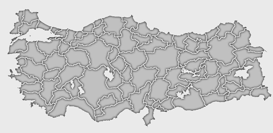
1280x625pxTokat Province map, Provinces of Turkey black and white, Istanbul region outline, Amasya location on map, Turkish geography illustration, blank Turkey provinces chart, Black Sea region cartography
742x866pxSouth America map, Latin America political map, blank Americas map, latino integration, South American geography, political boundaries Americas, continental map analysis
900x900pxKerala Map, India silhouette, blank Kerala map, travel Kerala, South India state, geographical outline, blue region map
1000x1000pxUkraine map, yellow and blue, travel Ukraine, Ukrainian symbol, Eastern European country, national flag design, geopolitical region
1280x800px3D Earth globe, world map sphere, raised relief map, geo information system, global geography, planet earth visualization, continental landmasses
1920x2400pxBangladesh silhouette map, black and white Bangladesh map, blank Bangladesh map, monochrome Bangladesh map, Bangladesh geographic outline, Bangladesh country shape, Bangladesh political borders
1486x610pxFlag of Indonesia Map, Indonesian travel map, blue world map, Indonesian area map, Southeast Asia map, country outline map, travel destination map
1600x1600pxangle rectangle frame, black multimedia display, internet media type resolution, display device area, digital screen outline, graphic design element, visual content border
2000x3000pxReligion in South Korea, South Korea map, Korean Buddhism, provinces of South Korea, Korean cultural geography, Korean religious landscape, Korean spiritual regions
1060x660pxEurope blank map, monochrome world map, black and white geography, cartography europe, political map analysis, continental borders visualization, geographic layout study
2000x2670pxGran Colombia map, Flag of Colombia silhouette, Colombia national flag, yellow Colombia map, South American historical maps, Colombian geography visuals, historical flag designs
500x721pxPeru political map, Lima city map, black and white world map, map of Peru, South America geography, country borders illustration, travel destination guide
1600x1000pxIndia silhouette map, black and white India map, India political map, India map collection, geographical outline of India, country borders of India, South Asia map illustration
1024x377pxFlag of Indonesia Map, black and white map, Indonesia line art, monochrome travel map, Southeast Asia geography, archipelago illustration, political boundaries
512x512pxglobe silhouette, monochrome earth symbol, black and white world icon, earth globe computer graphic, global geography illustration, planet earth outline, universal world map design
1095x2246pxPortugal flag map, red and green flag, Flag of Portugal, national flag, Portuguese geography, Iberian Peninsula map, European country flags
2937x2645pxBrazil regions map, South Region Brazil geography, Southeast Region Brazil political division, North Region Brazil ecoregion, Brazilian state boundaries, map of Brazilian territories, Brazilian regional subdivisions
2339x1377pxRussia Map silhouette, black and white Russia map, blank Russia map, monochrome world map, Russian geography outline, Eurasian landmass shape, northern hemisphere cartography
359x768pxArgentina blank map, Argentine Northwest geography, black and white outline, coloring book map, South American cartography, silhouette map, travel atlas design
1812x1114pxFalkland Islands map, Stanley Falkland Islands, Flag of the Falkland Islands, Port Louis Falkland Islands, Falkland Islands geography, Falkland Islands flag design, Falkland Islands political map
2000x1602pxFlag of Nigeria, Nigeria map outline, Nigerian national symbol, green and white design, African country borders, Nigerian geography visual, Nigerian emblem shape
734x815pxIndia silhouette map, black and white India map, monochrome India outline, India map, geographical representation of India, country shape illustration, Indian subcontinent outline
1428x732pxworld map mercator projection, monochrome political map, south-up world map, blank map for coloring, global geography illustration, international borders outline, cartographic design elements
1001x555pxRussia political map, карта россии, world map cartography, mapa polityczna Russia, Russian federation regions, geopolitical boundaries, Eurasian territories
1200x630pxIndonesia flag map, red and white country illustration, Pembela Tanah Air map, Indonesian national symbol, Southeast Asia cartography, patriotic design elements, historical geography visuals
563x618pxBlank Africa map, Africa world map, Blank map Africa, Africa outline, African continent map, unmarked Africa map, Africa geography chart
5748x5852pxEarth World Globe, Cartoon World Map, green planet illustration, free content globe image, global geography graphic, world atlas visual, spherical earth depiction
1200x1584pxColombia departments map, Putumayo Department outline, Boyacá Department geography, blank map of Colombia, Colombian regional boundaries, South American departmental divisions, cultural regions of Colombia
980x914pxFlag of Pakistan, blank map, black silhouette, monochrome map, Pakistan geography, political borders, country outline
1115x1280pxIndia flag map, Indian national symbol, tricolor India map, blank India map, political map of India, Ashoka Chakra design, Indian geography outline
624x630pxEarth Globe Sketch, black and white globe drawing, monochrome world map illustration, line art earth diagram, global geography sketch, planet earth outline, terrestrial globe artwork
943x1091pxblank India map, states and territories of India outline, monochrome Indian political map, central India geography, Indian borderlines illustration, subcontinental regions layout, location markers on India无声無息无声无息无声无息China
640x521pxSpain blank map, autonomous communities outline, black and white geography map, spain political regions, spain educational map, spain regional divisions, spain line art map