1000x365pxIndonesia blank map, black silhouette map, monochrome world map, outline map of Indonesia, geographical outline, travel map design, cartographic illustration
700x700pxIndia silhouette map, India map drawing, India world map, India map design, Indian subcontinent outline, South Asia map illustration, India geographic shape
7506x8000pxIndia blank map, orange India silhouette, India world map design, stock India map, Indian geography outline, map of South Asia, India political borders
1200x1200pxIndia monochrome map, Indian silhouette map, blank India map, black and white India map, India geographic outline, India country shape, India border illustration
1502x1658pxAfrica silhouette map, black and white Africa map, monochrome Africa graphic, blank Africa map, African continent outline, geographical Africa shape, Africa continent
4186x1562pxNew York City skyline silhouette, monochrome cityscape illustration, skyscraper building silhouettes, urban metropolis outline, architectural design elements, cityscape graphics, high-rise urban structures
510x540pxIndia Globe Map, India world map, orange India map, blank India map, geographical representation, cartographic design, subcontinent outline
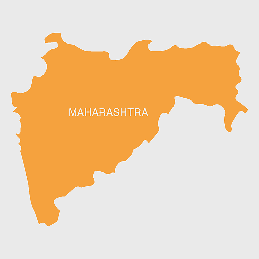
675x421pxMaharashtra map, Maharashtra state outline, Maharashtra geography, Maharashtra region, India state maps, map of Indian states, Maharashtra borders, png
700x838pxIndia Map illustration, India political map, blank India map, India state boundaries, Indian subcontinent geography, South Asia cartography, detailed India region map
900x900pxKerala Map, India silhouette, blank Kerala map, travel Kerala, South India state, geographical outline, blue region map
800x1000pxblack shield outline, blank shield logo template, monochrome shield design, black and white shield icon, heraldic shield silhouette, shield illustration, minimalist shield graphic
900x900pxKarnataka Legislative Assembly election map, India political map, yellow Karnataka outline, Karnataka election results map, Indian state boundaries, regional election visualization, political geography of Karnataka
500x500pxMaharashtra blank map, black and white silhouette, travel world map, stock map image, geographic outline, state boundary illustration, cartographic design
2480x3508pxAfrica Map, orange continent, world Map, emblem Of The African Union, African geography, cartographic design, orange silhouette
1600x775pxsocial media audience silhouette, crowd of people silhouettes, monochrome crowd graphic, public relations visual, group dynamics illustration, community engagement icon, social gathering outline
736x507pxRussia orange map, Russian city map, blank Russia map, scale map of Russia, Russian geography, political map of Russia, Russian urban areas
595x689pxIndia blank map, political map of India, outline of India, white line map, geographical visualization, country borders, subcontinent layout
512x512pxglobe silhouette, monochrome world icon, black and white earth symbol, desktop globe image, global map outline, planet graphic, universal symbol illustration
892x906pxBrazil regions map, blank Brazil map, political map of Brazil, ecoregions of Brazil, South American geography, Brazilian states outline, map of Brazilian territories
694x981pxOrange City flyer design, city silhouette layout, modern architecture presentation, standard paper size template, urban skyline brochure, graphic design elements, cityscape advertising layout
512x512pxChrysler city car silhouette, compact car black and white, motor vehicle service angle, race car monochrome, automotive design outline, vehicle door graphic, car dealership illustration
900x900pxNizamabad District Map, Telangana State Outline, India Political Map, Yellow Region Highlight, Geographical Borders, Administrative Division, Regional Cartography
980x618pxblack silhouette USA map, blank United States map, monochrome map of USA, travel world map USA, geographic outline of America, continental United States shape, minimalist USA cartography
734x815pxIndia silhouette map, black and white India map, monochrome India outline, India map, geographical representation of India, country shape illustration, Indian subcontinent outline
500x500pxPaper Technology roadmap, road with pins illustration, Technology roadmap, city Map, strategic planning, visual navigation, milestone markers
1024x1024pxJapan map silhouette, black and white Japan map, Japan prefectures outline, monochrome Japan map, Japanese geography illustration, Asia travel icon, country shape graphic
518x590pxTelangana state map, India blank map, states and territories of India, road map of India, political map of India, geographical map illustration, cartographic representation of India
359x768pxArgentina blank map, Argentine Northwest geography, black and white outline, coloring book map, South American cartography, silhouette map, travel atlas design
2339x1377pxRussia Map silhouette, black and white Russia map, blank Russia map, monochrome world map, Russian geography outline, Eurasian landmass shape, northern hemisphere cartography
1115x1280pxIndia flag map, Indian national symbol, tricolor India map, blank India map, political map of India, Ashoka Chakra design, Indian geography outline
2400x1800pxMaharashtra Map illustration, UK geography, monochrome area diagrams, line art states, geographic boundary outlines, regional cartography design, geopolitical zone mapping
1024x1024pxRajasthan map, blue map outline, travel world map, blank map template, geographical region, state boundary, cartographic design
1600x1000pxIndia silhouette map, black and white India map, India political map, India map collection, geographical outline of India, country borders of India, South Asia map illustration
943x1091pxblank India map, states and territories of India outline, monochrome Indian political map, central India geography, Indian borderlines illustration, subcontinental regions layout, location markers on India无声無息无声无息无声无息China
512x512pxglobe silhouette, monochrome earth symbol, black and white world icon, earth globe computer graphic, global geography illustration, planet earth outline, universal world map design
1920x2400pxBangladesh silhouette map, black and white Bangladesh map, blank Bangladesh map, monochrome Bangladesh map, Bangladesh geographic outline, Bangladesh country shape, Bangladesh political borders
1428x732pxworld map mercator projection, monochrome political map, south-up world map, blank map for coloring, global geography illustration, international borders outline, cartographic design elements
671x692pxIndia 3D map, turquoise India map, 3D computer graphics map, India world map, digital India cartography, 3D geographic visualization, aqua cartographic design
800x738pxAustralia monochrome map, black silhouette world map, Australia blank map, geography atlas, Australian continent outline, global monochrome cartography, earth silhouette illustration
2000x2000pxblack Brazil map illustration, Flag of Brazil blank map, black and white cartography, topo map of Brazil, geographic outline of Brazil, line art map design, early world map style
2400x1800pxTamil Nadu map outline, black and white India map, monochrome line art map, travel diagram India, geographic boundary illustration, state region outline, cartographic sketch Tamil Nadu
768x768pxHaryana blank map, Haryana silhouette, states of India map, black and white Haryana map, India geography outline, Haryana region illustration, Indian state borders graphic
540x600pxwhite t-shirt template, black and white tshirt, t-shirt design outline, monochrome clothing illustration, blank apparel graphic, minimalist fashion sketch, simple tee silhouette
1601x1920pxIndia map outline, India geographic shape, India country borders, India silhouette, map design, geographical illustration, country outline graphic, png
600x656pxIndia map silhouette, orange and green India map, blank India map, geography of India, Indian subcontinent map, South Asia map outline, India topography visualization
1200x1584pxColombia departments map, Putumayo Department outline, Boyacá Department geography, blank map of Colombia, Colombian regional boundaries, South American departmental divisions, cultural regions of Colombia
1656x2282pxBangladesh blank map, green map outline, mercator projection map, travel world map, geographic region, country borders, cartographic design
960x768pxSprite explosion animation, 2D game graphics, orange explosion sprites, texture mapping effects, fiery visual effects, digital art assets, animation development resources
800x583pxMexico United States border map, blank political map, black and white world map, monochrome country diagram, international geography layout, cartographic line art, travel destination atlas
1600x1600pxbusiness process icons, enterprise architecture symbols, company strategy maps, monochrome organization visuals, corporate innovation graphics, management communication diagrams, human behavior silhouettes
900x900pxIndia blank map, monochrome India silhouette, India map line art, black and white India map, India geographic outline, India country shape, India political borders
1463x1238pxEurope Map, blue silhouette map, travel world map, European geography, continent outline, cartographic design, regional borders
1024x681pxworld map silhouette, black and white world map, monochrome world map, world map countries, global geography illustration, international map outline, earth continents graphic
640x586pxEurope blank map, European political map, black and white globe, world map pattern, geographic layout, cartographic design, continental outline
799x334pxworld map silhouette, black and white globe decal, monochrome world map, blank map wall art, global geography decor, earth outline sticker, international atlas design
600x600pxparty silhouette illustration, monochrome event graphics, black and white party people, dj event visuals, festive crowd outline, celebration, dance night silhouettes
980x914pxFlag of Pakistan, blank map, black silhouette, monochrome map, Pakistan geography, political borders, country outline
700x700pxSpain silhouette map, black and white Spain map, mercator projection Spain, blank Spain map, geographic illustration, peninsular outline, isolated monochrome map
1208x1208pxEuropean Union Map, info map Europe, European continent outline, европа карта, Geo-political boundaries visualization, Cartographic European regions, International borders depiction
846x914pxDelhi Legislative Assembly election 2015 map, Delhi Legislative Assembly election 2013 map, blank Delhi map, India political map, Delhi electoral districts, Indian state elections, political geography of Delhi
606x600pxUttar Pradesh map, black and white map, blank map of Uttar Pradesh, travel map India, geographical outline, state boundaries, regional division
4152x4612pxWest Germany flag map, Germany national flag silhouette, blank map of West Germany, red yellow black Germany colors, German historical borders, European country outline, German travel landmarks
4351x3416pxGujarat state map, Gujarat geographical layout, Gujarat district boundaries, Gujarat region outline, Indian state cartography, regional mapping, administrative divisions visualization, png
2400x1392pxUnited States blank map, U.S. state outline, black and white map, geography line art, political map of America, educational map design, USA state borders illustration
512x512pxmap icon, leaf symbols, turn-by-turn navigation, city map design, geographic location, cartographic visual elements, digital map representation
993x646pxRussia map silhouette, blank Russia map, Russian geography outline, black and white Russia outline, Eurasian region borders, political map of Europe and Asia, Slavic states boundaries
4167x2233pxblack and white world map, monochrome global silhouette, digital world atlas, black map outline, planetary geography, international cartography, earth chart graphics
875x583pxMaharashtra map, Chief Minister Government, Devendra Fadnavis, India travel, Maharashtra regional divisions, map of states with percentages, Maharashtra political geography
900x845pxyellow 3D button circle, glossy texture mapping illustration, three-dimensional label material, orange circle frame tag, bright graphic design, visual texture elements, digital art resources
512x512pxUttar Pradesh map, silhouette, travel World, green design, Indian state outline, geographical boundary, map graphic
980x512pxFish silhouette shadow, marine fauna icons, black and white fish art, fish tail and fin outlines, aquatic shadow graphics, underwater biology visuals, oceanic creature silhouettes
456x1338px3D computer graphics rendering, child silhouette texture mapping, standing figure in jeans, architectural visualization design, casual outfit with shoulder bag, urban lifestyle, digital art composition
500x1220pxIsrael-Palestine silhouette, Spiritual Guidance Australia logo, black and white map outline, monochrome country shape, geopolitical region graphic, spiritual guidance symbol, Middle East territory illustration