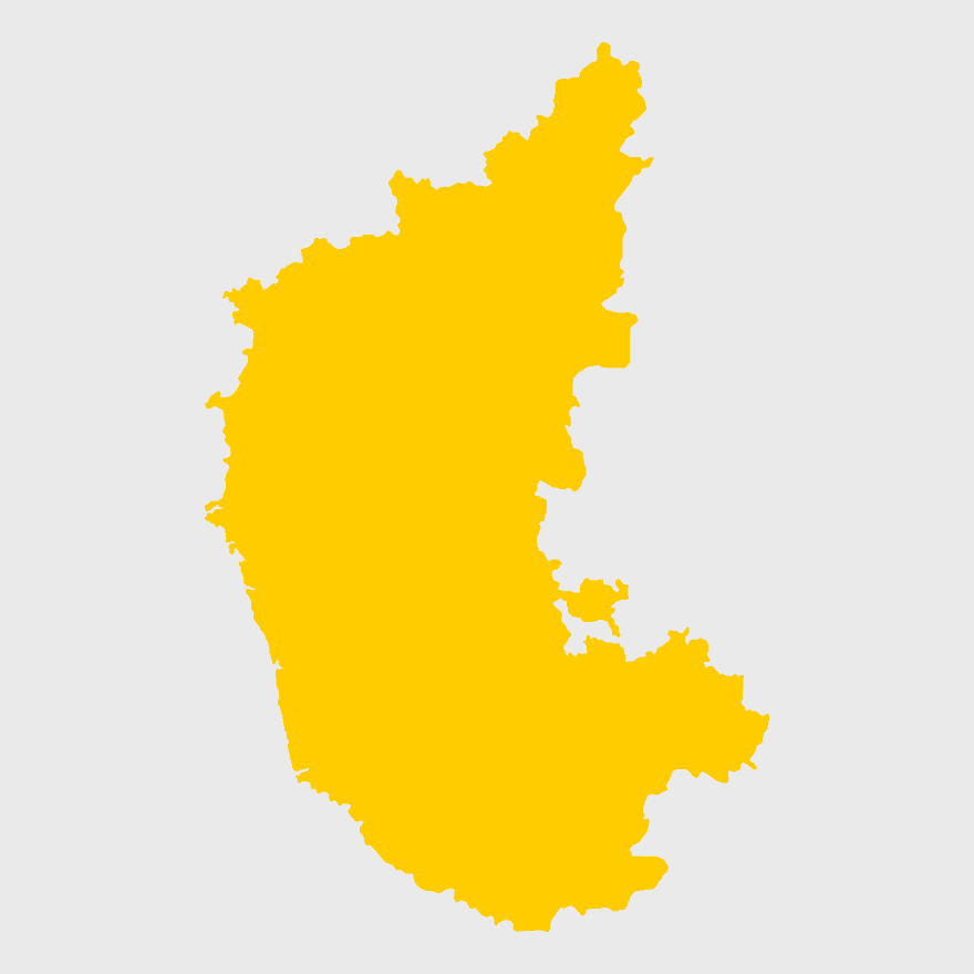
Karnataka Legislative Assembly election map, India political map, yellow Karnataka outline, Karnataka election results map, Indian state boundaries, regional election visualization, political geography of Karnataka, PNG free download
Karnataka Legislative Assembly election map, India political map, yellow Karnataka outline, Karnataka election results map, Indian state boundaries, regional election visualization, political geography of Karnataka
7506x8000pxIndia blank map, orange India silhouette, India world map design, stock India map, Indian geography outline, map of South Asia, India political borders
700x700pxIndia silhouette map, India map drawing, India world map, India map design, Indian subcontinent outline, South Asia map illustration, India geographic shape
1280x580pxred and white map illustration, Flag of Indonesia Brunei Map, greater Indonesia map, blank map with flag design, Southeast Asia political map, cartographic design elements, regional geography illustration
700x838pxIndia Map illustration, India political map, blank India map, India state boundaries, Indian subcontinent geography, South Asia cartography, detailed India region map
2000x2171pxTamil Nadu Government Seal, Tamil Nadu Legislative Assembly emblem, State Emblem of India, gopuram temple illustration, Indian state symbols, Tamil Nadu official logo, South Indian government insignia
675x421pxMaharashtra map, Maharashtra state outline, Maharashtra geography, Maharashtra region, India state maps, map of Indian states, Maharashtra borders, png
1200x1200pxIndia monochrome map, Indian silhouette map, blank India map, black and white India map, India geographic outline, India country shape, India border illustration
900x900pxNizamabad District Map, Telangana State Outline, India Political Map, Yellow Region Highlight, Geographical Borders, Administrative Division, Regional Cartography
892x906pxBrazil regions map, blank Brazil map, political map of Brazil, ecoregions of Brazil, South American geography, Brazilian states outline, map of Brazilian territories
1200x641pxRussia blank map, black and white Russia map, monochrome Russia map, white Russia map, Russian geography, political map of Russia, Russia outline map
900x900pxKerala Map, India silhouette, blank Kerala map, travel Kerala, South India state, geographical outline, blue region map
742x866pxSouth America map, Latin America political map, blank Americas map, latino integration, South American geography, political boundaries Americas, continental map analysis
595x689pxIndia blank map, political map of India, outline of India, white line map, geographical visualization, country borders, subcontinent layout
900x900pxTamil Nadu Legislative Assembly election 2016 results, AIADMK political party, Tamil Nadu state assembly elections, yellow electoral map, Indian state election outcomes, political geography of Tamil Nadu, regional election analysis
2602x1952pxEurope political map, European globe map, world geography, European area map, European continent map, European countries outline, European map illustration
943x1091pxblank India map, states and territories of India outline, monochrome Indian political map, central India geography, Indian borderlines illustration, subcontinental regions layout, location markers on India无声無息无声无息无声无息China
1115x1280pxIndia flag map, Indian national symbol, tricolor India map, blank India map, political map of India, Ashoka Chakra design, Indian geography outline
846x914pxDelhi Legislative Assembly election 2015 map, Delhi Legislative Assembly election 2013 map, blank Delhi map, India political map, Delhi electoral districts, Indian state elections, political geography of Delhi
1024x377pxFlag of Indonesia Map, black and white map, Indonesia line art, monochrome travel map, Southeast Asia geography, archipelago illustration, political boundaries
734x815pxIndia silhouette map, black and white India map, monochrome India outline, India map, geographical representation of India, country shape illustration, Indian subcontinent outline
1280x640pxParliament of India, Indian Government Architecture, National Landmark, Indian Flag, Historical Building, Legislative Assembly, Civic Structure, png
1001x555pxRussia political map, карта россии, world map cartography, mapa polityczna Russia, Russian federation regions, geopolitical boundaries, Eurasian territories
2000x2670pxGran Colombia map, Flag of Colombia silhouette, Colombia national flag, yellow Colombia map, South American historical maps, Colombian geography visuals, historical flag designs
1600x1135pxworld map illustration, mercator projection map, elegant world map design, political world map, global geography infographic, international borders visualization, earth continents layout
2937x2645pxBrazil regions map, South Region Brazil geography, Southeast Region Brazil political division, North Region Brazil ecoregion, Brazilian state boundaries, map of Brazilian territories, Brazilian regional subdivisions
2400x1800pxMaharashtra Map illustration, UK geography, monochrome area diagrams, line art states, geographic boundary outlines, regional cartography design, geopolitical zone mapping
500x500pxMaharashtra blank map, black and white silhouette, travel world map, stock map image, geographic outline, state boundary illustration, cartographic design
1600x1000pxIndia silhouette map, black and white India map, India political map, India map collection, geographical outline of India, country borders of India, South Asia map illustration
1024x968pxMaharashtra Government Logo, Mumbai Government emblem, India public sector symbol, Maharashtra official crest, Indian state administration, regional governance icon, government authority mark
512x512pxMaharashtra Blank map, orange silhouette map, road map topo, city map India, geospatial visualization, state boundary outlines, cartographic graphic design
446x729pxsouth Korean Presidential Election 1967 map, Seoul black and white silhouette, Korean Peninsula monochrome illustration, South Korea election geography, political history of Korea, historical election visuals, Asian political cartography
768x768pxSpecial Status Andhra Pradesh, Andhra Pradesh Legislative Assembly election, blue India map, electoral district Andhra Pradesh, Andhra Pradesh political map, N Chandrababu Naidu protests, Andhra Pradesh government policies
1060x660pxEurope blank map, monochrome world map, black and white geography, cartography europe, political map analysis, continental borders visualization, geographic layout study
1200x1584pxColombia departments map, Putumayo Department outline, Boyacá Department geography, blank map of Colombia, Colombian regional boundaries, South American departmental divisions, cultural regions of Colombia
768x768pxHaryana blank map, Haryana silhouette, states of India map, black and white Haryana map, India geography outline, Haryana region illustration, Indian state borders graphic
518x590pxTelangana state map, India blank map, states and territories of India, road map of India, political map of India, geographical map illustration, cartographic representation of India
1024x1024pxRajasthan map, blue map outline, travel world map, blank map template, geographical region, state boundary, cartographic design
1428x732pxworld map mercator projection, monochrome political map, south-up world map, blank map for coloring, global geography illustration, international borders outline, cartographic design elements
800x1200pxSouth Korean presidential election 2017 map, provinces of South Korea, black and white Korea map, South Korea blank map, Korean political geography, Korean election results visualization, Korean regional boundaries
1080x1920pxIndia flag map, tricolor Indian flag, National flag of India art, India design outline, patriotic Indian symbol, emblem of Indian national identity, subcontinent cultural flag representation
1280x625pxTokat Province map, Provinces of Turkey black and white, Istanbul region outline, Amasya location on map, Turkish geography illustration, blank Turkey provinces chart, Black Sea region cartography
2400x1800pxTamil Nadu map outline, black and white India map, monochrome line art map, travel diagram India, geographic boundary illustration, state region outline, cartographic sketch Tamil Nadu
2000x3957pxFlag of Sweden map, Sweden-Norway Union map, blue and yellow flag, political map of Sweden, Scandinavian geography, Nordic borders, historical union map
1024x570pxAam Aadmi Party logo, black brush stroke, Punjab Legislative Assembly election 2017, Arvind Kejriwal campaign, political party emblem, Indian election symbol, chief minister election graphic
2206x2190pxEuropean Union member states map, Flag of Europe, UK map, Eurozone countries, European geography, EU political boundaries, European Union membership
507x552pxIndia map outline, Kalady Ripple Ethereum Hinduism, Adi Shankara Alvars, line art map, Indian subcontinent geography, spiritual traditions India, cryptocurrency in India
4351x3416pxGujarat state map, Gujarat geographical layout, Gujarat district boundaries, Gujarat region outline, Indian state cartography, regional mapping, administrative divisions visualization, png
640x521pxSpain blank map, autonomous communities outline, black and white geography map, spain political regions, spain educational map, spain regional divisions, spain line art map
605x605pxElectronic voting in India, Indian electronic voting machines, bharatiya Janata Party election results, bahujan Samaj Party polling, digital democracy in India, modern election systems, voting technology advancements
1463x1238pxEurope Map, blue silhouette map, travel world map, European geography, continent outline, cartographic design, regional borders
3638x4000pxIndia states and territories map, blank India map, India political map, India regions map, Indian subcontinent map, India administrative divisions, India geography map
851x936pxMizoram cultural heritage tourism, Incredible India advertising, India map illustration, heritage tourism in India, Indian state landmarks, travel map of India, cultural diversity in India
2000x1602pxFlag of Nigeria, Nigeria map outline, Nigerian national symbol, green and white design, African country borders, Nigerian geography visual, Nigerian emblem shape
980x914pxFlag of Pakistan, blank map, black silhouette, monochrome map, Pakistan geography, political borders, country outline
600x656pxIndia map silhouette, orange and green India map, blank India map, geography of India, Indian subcontinent map, South Asia map outline, India topography visualization
1928x1920pxBrazil map flag, Brazilian flag design, Brazil country outline, Brazil national symbol, South America geography, green and yellow emblem, Ordem e Progresso motto
1068x348pxFlipkart India logo, blue text retail brand, yellow shopping bag icon, online shopping offers, e-commerce platform visual, digital retail service, Indian online marketplace
993x646pxRussia map silhouette, blank Russia map, Russian geography outline, black and white Russia outline, Eurasian region borders, political map of Europe and Asia, Slavic states boundaries
1600x1527pxRegional Representative Council, Indonesia government emblem, garuda pancasila symbol, People's Consultative Assembly, Indonesian political institutions, national unity icon, legislative body insignia
800x583pxMexico United States border map, blank political map, black and white world map, monochrome country diagram, international geography layout, cartographic line art, travel destination atlas
1208x1208pxEuropean Union Map, info map Europe, European continent outline, европа карта, Geo-political boundaries visualization, Cartographic European regions, International borders depiction
2400x1392pxUnited States blank map, U.S. state outline, black and white map, geography line art, political map of America, educational map design, USA state borders illustration
960x1132pxIndia map silhouette, Indian geographic region, high-resolution India outline, India political divisions, India landmass representation, silhouette illustration of India, Indian subcontinent visual map
2000x2025pxNetherlands Flanders map, Greater Netherlands flag, Dutch flag colors, Flanders region map, European political geography, Netherlands cultural regions, Netherlands historical territories
900x900pxIndia blank map, monochrome India silhouette, India map line art, black and white India map, India geographic outline, India country shape, India political borders
637x738pxLatin America Map, South America map, Caribbean political map, Maxxess Systems Inc coverage areas, Americas regional map content, examined world cartography, distinctive map visualizations
555x560pxEuropean Union map, flag of Europe, blue and yellow stars, European Union citizenship, European geography, European political union, European integration
3004x2002pxworld map for nursery, Antarctica continent map, wall decal world map, physical geography map, earth visualization art, continental eco-regions illustration, global atlas design
875x583pxMaharashtra map, Chief Minister Government, Devendra Fadnavis, India travel, Maharashtra regional divisions, map of states with percentages, Maharashtra political geography
1600x1054pxTelugu Desam Party logo, Andhra Pradesh politics, red bicycle illustration, Indian political symbols, cycling culture in India, political party emblems, transportation in Telugu regions
2000x10865pxSantiago Chile map, monochrome regions of Chile, Chilean election map, black and white silhouette, Chile political divisions, Chilean geography outline, Chile travel regions
1644x2400pxColombia map, monochrome map, black and white map, travel world map, South America geography, political boundaries, regional divisions
820x819pxBharatiya Janata Party logo, Pataudi Vidhan Sabha constituency election, BJP lotus symbol, Narendra Modi political party, Indian political party emblem, Indian election campaign visuals, BJP party branding elements
606x600pxUttar Pradesh map, black and white map, blank map of Uttar Pradesh, travel map India, geographical outline, state boundaries, regional division